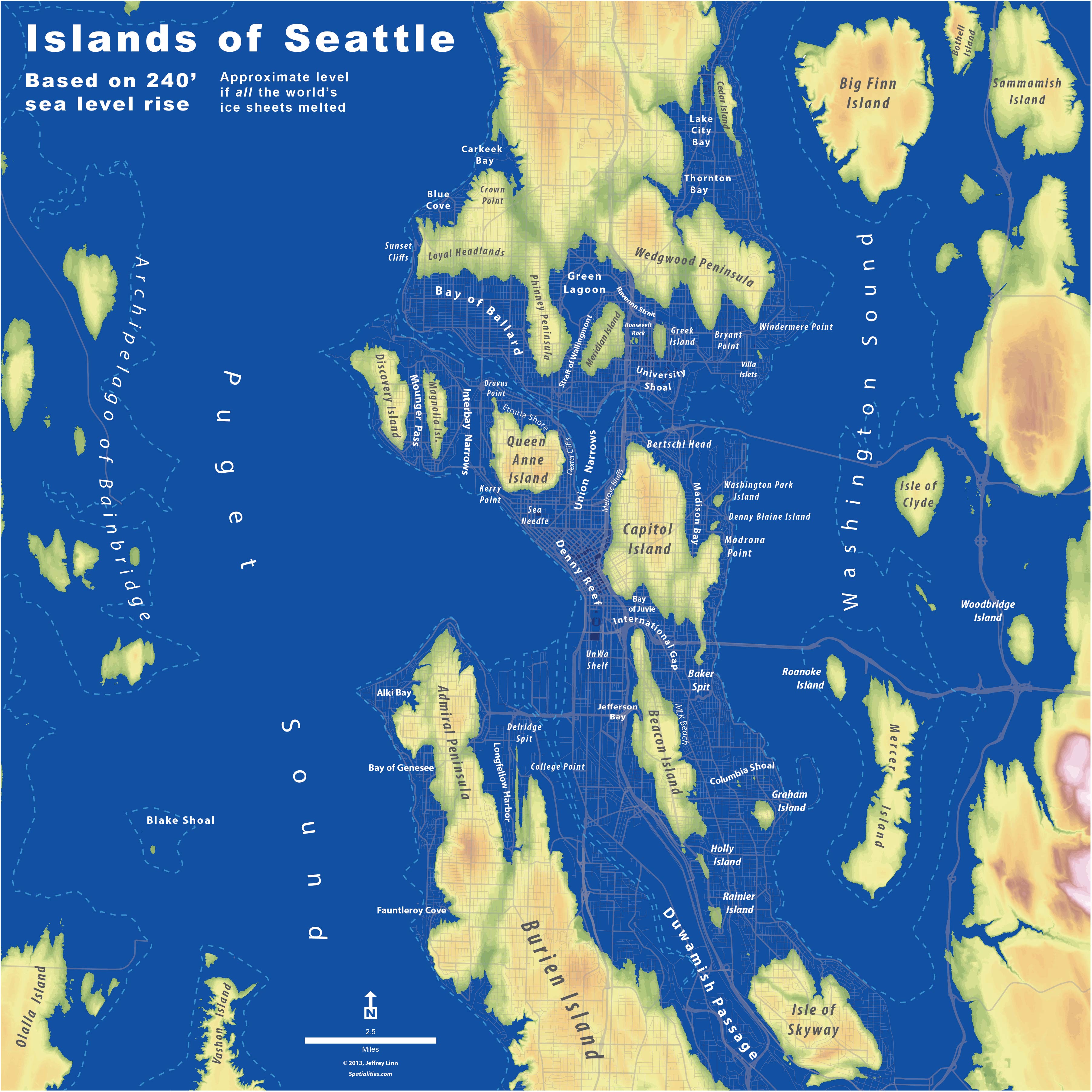
Denny Way turns into Denny Reef. The U District morphs into University Shoal. The Space Needle becomes the Sea Needle.
Jeffrey Lin, a campus planner at University of Washington with a background in geography, wondered what Seattle would look like if all the Earth’s ice sheets melted in a catastrophic global warming event. So he did some calculations and drew up a map of the city under 240 feet of water.
Turns out, the Emerald City becomes the Emerald Isles, straight out of 1995’s Waterworld.
Capitol Hill turns into Capitol Island, where the stranded denizens would have nowhere to bike after brunch but straight into the Sound. All of the city’s frat houses would be isolated on “Greek Island,” a place that would likely put Ibiza to shame. Mercer Island is… well it’s still an island.
Explore our post-apocalyptic city below, and click on the picture for a larger, hi-res version you can zoom in on. Did your house make it through the melt?


